
by Travis Gill
Ever since we discovered adventure motorcycling, my wife, Chantil, and I have dreamed of riding Baja. This was our first motorcycle trip outside the protective womb of the USA and I was a bit nervious if not a little scared. To calm the concerns I planned, planned, and planned some more. The following is just a small glimpse into the planning process. Perhaps it will help others who feel the same anxiety but can’t shake the desire to discover Baja on thier own.
Mission Planning

All the preparation and a little bit of lack of preparation has got us to this moment. I’ve never prepared as much for a trip. Part of the reason for the preparation are the concerns I have about traveling in a country I don’t know much about other than what I’ve read. The US Department of State travel warnings were a bit scary to read. If you believe the headlines about Mexico you may get the feeling that nearly every American who visits is victim to some act of robbery or violence. There is no shortage of people who warn “I once had a friend who (insert your terrorizing story here)!” Military checkpoint, crooked cops, drugs, Trump’s “bad hombres”, and chupacabra! What is an adventure rider to do?
We considered:
- The route: A HUGE thanks to gpsKevin for publishing the routes of his previous trips. I did extensive research on each day of our trip using gpsKevin’s routes as a guide. Having a magenta line to follow in a new world was a humungous comfort. Link: https://sites.google.com/site/gpskevin/gpskevin-ride-calendar/baja-california-discovery-route-2016
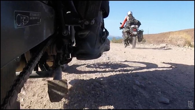
- Our two mules: Both BMW G650GS. My 2012 Sertao, named Apache, has about 20K miles and Chantil 2011 mule, Chocolate, has almost 30K miles. They are outfitted for overland travel. My gear and bags weigh nearly 90 lbs. I weight, with all my riding gear, 210 lbs.
- Gear: We have always been proponents of All The Gear, All The Time (ATGATT). I even wear a neck brace.
- Night: No riding at night. We heard horror stories of stray animals and loco semi-truck drivers. No, gracias.
- Fuel: Each of our mules has a range of about 185 miles. An extra 1.75 gal RotoPax gets us another 50 miles each. We heard you can buy gasolina from almost anyone so we should be ok.
- Water: We each carry a 3-liter Camelback and another 1.75 gal RotoPax between the two of us. It should be enough for a day or two of riding off the beaten path.
- Spanish: My Spanish is poor. Chantil’s is even worse. I took two years in high school so I know how to pronounce words and I can read a bit. Understanding spoken Spanish is another level that I don’t feel comfortable with. Downloading the Spanish dictionary into the Google Translate app proved to be a blessing. We also had a small pocket phrasebook but I never even opened it during the entire trip.
- Documentation: Passport, Driver License, FMM tourist card, and insurance were with me in my motorcycle jacket pocket. Other documents stayed in the tank bag.
- Pesos: We didn’t use an ATMs or credit card the entire trip. We exchanged about 19,000 pesos ($1,000 UDS) before the trip. Believe me, 19,000 pesos is a big wad of cash. We distributed the money between the two bikes. I carried less than 1,000 pesos in my pocket. I also had a throw-away wallet with some old ATM cards, an old ID, and some pesos just in case all the horror stories were true.
- Communication: Although I had the option of using Verizon wireless it turned out that everywhere I checked for a signal there was none. All towns had restaurants with WiFi. We activated our Garmin inReach for the duration of our trip but never even turned it on other than to check that is was functional before leaving on the trip.
There was a bit of lack or preparation as well. We attempted to do this trip in March but I discovered that my passport had expired about 5 weeks before our scheduled trip. No passport, no Mexico. A new one arrived about three weeks before the trip.
In addition to the passport issue, I had my wallet stolen on a recent Death Valley trip (Yes, in the great US of A). I needed to wait for a new drivers license that was mailed from Florida. It ended up arriving the day before we left on our trip – how’s that for timing?!
We purchased motorcycle insurance for the 9 days we were expecting to be in Baja. It costed $118.79 USD for each of the mules. Talk about bad hombres. Robbery.
Finally, we pre-purchased the Forma Migratoria Multiple (FMM) online. Technically it’s required for visits to Mexico longer than 7 days. It costed 500 pesos (~$26 USD) for each of us.
Baja Trip – Day 1 of 9
🗓: 22 Apr | 🌍: San Diego, USA to Mike’s Sky Rancho, Baja

Day 1: 106 miles paved + 91 miles dirt = 197 total miles (317 km)
After finishing up the last bit of packing we were on the road around 8AM. After an hour of riding on Otay Lakes Road, Campo Road, and then to Tecate Road we crossed into Mexico via the Tacate entry point. Entering the country was as easy as rolling up to a flip gate, waiting a few seconds, wait for the gate to flip open, and then proceed in Mexico. We park at the inspection area expecting that officials would need to look at our paperwork and bikes. No one seemed to care about the bikes; only cargo vans or trucks. We were motioned to park around the fence to the right. A teenage security guard was in charge of watching the parking spots. He seemed to spend more time on his smart-phone but at least he sat next to the bikes. We decided to have Chantil watch the bikes while I went to find out how to get our FMM and passports processed and stamped. Getting into the office proved to be a maze; I had to cross the street, walk back into the US side, and then cross another street, before walking into a small office. I greeted myself to a large mustached señor who sat behind a computer. I showed him my paperwork and he grumpily asked me to fill out the FMM. I politely tried to explain that I had already filled it out online and showed him the receipt but he didn’t seem to care. The receipt didn’t look like the form he handed me so I went to filling it out. Many of the boxes were in English so I didn’t have to translate via my smart phone. I handed him the form and my passport and he demanded I pay the 500 pesos. I told him in Spanish that I had already paid and showed him the receipt. He didn’t care and told me I had to go see the cashier and pay the 500 pesos before he would stamp my passport. I walked to the cashier and tried to explain that I had paid and again showed my receipt. He made a call to someone and then replied that it didn’t matter; I still had to pay. At this point I’m a bit fed up. I know that the FMM is only required if you spend more than 7 days in country but I’m not willing to pay the fee again. I decide to tell him that I’ll only be in Mexico for 7 days and then he sends me back to the original señor. I again explain that I’ll only be in country for 7 days and he reluctantly stamps the FMM and passport. Ugh, bureaucracy. At least I only wasted 30 minutes. I’ve heard that other countries can be a lot worse.
Chantil was patently waiting the whole time by the bikes. I didn’t want her to deal with the same thing I did so I went with her to explain the process. The grumpy señor was much nicer to Chantil and he stamps her paperwork and we proceed though a bag scanner and back to the bikes.
Before long we are riding the streets of Tacate. We’ve already been warned that Mexicans don’t stop for ALTO (STOP) signs so we are ready. We were surprised how true this is. It seems all Mexicans treat ALTO signs as YIELDs. We stop anyhow since we don’t want our first minutes of our trip to be sidelined by a corrupt cop looking for some lunch money.
There is an immediate difference between the two borders. Many of the streets in Baja are just packed dirt. The paved ones are narrow and many don’t have any lines painted on them. The ALTO signs are haphazardly placed at different sides of the intersection and many are covered by other street signs or overgrown vegetation. The building seem a bit more run-down than those on the US side. Our tensions were high as we proceeded away from Tacate to the east and onto the Mexican Federal Highway 2.
Highway 2 has a section that is free or tolled. We decide to take the tolled section. A small fee puts you on some of the most beautiful pavement in Baja. A wide, two-laned, shouldered, highway gets us away from the chaotic streets of the border town of Tacate. It’s funny; Baja has figured out how to get the US tourists to pay for it’s nicest roads.
We are making good time on the highway and begin to relax a bit. Before long we are looking for the exit that will put us near Ejido Baja California and onto the first dirt of the day via Luis EcheverrÍa Alvarez-Santa Lucía Road. Once on the dirt, we feel like we are in our element – no people – no cars – just the two of us enjoying the road and the sunny day.


The dirt continued uneventfully south towards Mexican Federal Highway 3. We didn’t experience too much trouble but did get into some deep sand for a short section. Chantil ended up being the first to drop her mule. It would be the first of about a handful of dismounts for each of us during the entire trip. Just before reaching Highway 3, we came across two gates and a farmer taking care of his animals. We were kindly asked to leave the gates open as we proceeded along the road. Our first interaction with folks while off-the-beaten-path and it was favorable!?! Where are all the bad hombres that Trump told us about?


Mexican Federal Highway 3 was a decent road that got us to Lazaro Card in short order. This was our first gas stop. The PEMEX station proved to be easy to navigate; a simple “Magna (87 octane), por favor.” and the attendant filled up our tank, took payment, and gave us change. I’m finding that I miss the PEMEX stations now that I am back in the US.


The dirt road from Lezaro Card to Mike’s Sky Rancho wasn’t too bad but we were getting tired. A group of riders barreled past us. We assumed they were heading to the same destination but it would be a little while before we met them. We ended up getting to Mike’s a bit after dark. It was a relief to get to our first destination after a long day of riding. 200 miles is a long day for us, especially when half of it is dirt.


I’ll share my thoughts on Mike’s Sky Ranch. I suspect that they are different than most but, after all, they are my thoughts. I’m not a huge fan of Mike’s. I felt like the prices for the meal, food, and camping was highly inflated for Baja. I understand that it’s out in the boonies and it’s a popular area for Baja racers, but does it justify the prices? I didn’t find Mike to be that welcoming; he didn’t really greet us, charged inflated exchange rates when paying in pesos, and seemed to pressure us into getting a room even though we just wanted to camp. The meal wasn’t that good, even though we were extremely hungry. I just don’t see the charm. Maybe it’s because I don’t drink. Again, my thoughts.
However, the other visitors we ran into were really nice and offered their advice on our next day’s itinerary. They seemed to show concern that our heavy bikes would have some issues on the roads south of Mike’s. They recommended another option and shared the GPS waypoints so I would be able to find the road the next morning. I’m glad we took their advice because we got to experience one of the most beautiful super-blooms we’ve ever witnessed.


After setting up our tent and sleeping bags in the grass next to the swimming pool, we drifted off to a well earned night of sleep. Until tomorrow…
Baja Trip – Day 2 of 9
🗓: 23 Apr | 🌍: Mike’s Sky Rancho to Vicente Guerrero, Baja

Day 2: 44 miles paved + 88 miles dirt = 132 total miles (212 km)
I woke up just before sunrise to the sounds of a rooster and a barking dog. Otherwise, the atmosphere was quiet at Mike’s since most folks decided to sleep in a bit before starting their day. I was able to walk around and snap some pictures at the beginning of what would be a beautiful day. I especially liked the abstract photo of the steps of the pool.


Today we were going to ride what was described to me as the “wine road”. It did involve some back tracking to the town of Lázaro Cárdenas, but we heard that we might be able to catch the motorcycle portion of the NORRA Mexican 1000 Rally. We also wanted to get an early start to ensure the we wouldn’t be sharing the road with the cars and trucks that would be racing later that day.

Once we broke down camp and packed the mules, we were on our way back north for a little bit before taking a right along the easiest road into and out of Mike’s. It was a well traveled section of graded dirt all the way to Highway 3.
Once on pavement it was a short jaunt to Lázaro Cárdenas where we were greeted by a somewhat intimidating Policía Federal or “Federales” truck at the intersection. There were several armed men, dressed in black with bandanas that cover their faces, standing in the bed of the black truck. I thought they were motioning me to pull alongside but later realized they were just motioning me to move along. To cover my confusion I asked “¿Gasolina?” and they pointed me in the direction of the PEMEX station down the road. By the way, this site had some good info on what to expect from military and police in Baja: LINK

After gassing up, we rode down the dirt road and found a restaurant serving breakfast. It offered a place to use the bathroom, wash your hands, breakfast of omelets and pancakes, and a nice patio to view the motorcycle racers rolling though the checkpoint between race sections. We answered a few questions about our trip from some folks who were there supporting one of the racers. They seemed impressed after noticing our Florida plates and mentioned “You two are a long way from Florida.” They were probably less impressed when we explained that we lived in San Diego and kept our Florida plates to maintain our Florida residency. It turns out they were heading to San Filipe that night and then heading south along the race route to finish in Cabo San Lucas four days later. It seems like a shame to being traveling that fast though Baja.

After a relaxing and fulfilling breakfast we saddled up the mules and were on our way to Highway 1 via the Camino a Lazaro Cardenas Road. This is a roughly 36 mile-long stretch of dirt road that winds around beautiful hills. It rewarded us with miles and miles (km and km) of beautiful flowers that bloomed from horizon to horizon. It really was a picturesque road and I think we were really blessed to have witnessed it during a super-bloom event.


The next 24 miles, riding south along Highway 1, gave us a break from the long afternoon of dirt and wash-boarded roads. As this point I realized that the chances of us arriving to our planned destination of San Quintín were unlikely. Our best bet for sleep that night was probably along the beach south of Vicente Guerrero.
Following the magenta GPSr track through town brought us to the Pacific Ocean where there were hundreds of large sacks of beach rocks. Most likely they were being harvested (is that the right word for rocks?) and distributed all over the world for decorative walls. We also walked around an abandoned church building. It surprises me that such a beautiful church next to the beach was just sitting there falling apart. The other surprise was just how isolated the beaches were; you could go miles and not see another person.


After a short break we continued south along a dirt, and sometimes sandy, road that parallel the beach. There were three sections of the road that had been washed away. Although there were bypasses, they were relatively steep. At one section, the climb out of the wash was so steep that I didn’t think we would make it up with the heavy bikes. Fortunately we had just ran into a group of dirt-bike riders and they helped me push the bikes up the hill. It was really nice of them to offer their help. Because of their generosity I was looking for an opportunity to “pay it forward” of sorts. Little did I know that an opportunity would come later that day.

One of the highlights of this particular beach was seeing the remains of the Mexican coastal freighter Isla del Carmen. Apparently the rumor is that she was run aground for insurance reasons in 1982. All that exists after 35 years of pounding ocean waves is the metal backbone of this once proud vessel.


After taking a short break at the Isla del Carmen, we returned to Highway 1 for a short nine-mile stretch of pavement before following the GPSr track through the town of Vicente Guerrero. As we were approaching the beach I realized our chance of paying it forward had arrived. There was a group of high-school-aged kids stuck in the sand with there two-wheel drive truck. They looked like they had been stuck for sometime. Although we could not understand each other we tried to push the truck free from the sand but to no avail. Realizing that we only had an hour before sunset I opted to reduce the tire pressure in the rear wheels. They seemed to understand what I was doing an offered a screw to help press the pressure release valve on the tire. Before long we had reduced the pressure on the rear wheels to 20 lbs. Next I motioned for a few of them to jump in the bed of the truck and put weight on the axle. As the driver pressed the gas, the tires dug in and the truck moved along without that much effort. They were free of the sand! We snapped this quick photo of the kids and me before waving goodbye. This good deed later paid off on day nine of our trip…

It was getting dark so we rode south a bit more to an isolated section of the beach and set up camp. Although it was blowing pretty hard, we managed to set up the tent and get it staked down with some large rocks for anchors. Once inside the tent it was relatively cozy. With the sound of the breaking waves of the Pacific Ocean, we both drifted off to a deep sleep within a short period of time.


Tomorrow we’ll have the pleasure of riding our mules on the beaches of the Pacific Ocean!…
Continued on PAGE 2…
